ADVENTURING: Welton Falls Trail

by Amy Patenaude
Outdoor/Ski Writer
Becca and I have many old guide books and maps and sometimes for fun we use them to go adventuring. My first guide, a 1976 gold hardcover centennial edition of the AMC White Mountain Guide, has many trails that no longer exist or have been rerouted so that they no longer resemble the original trail.
Trails are closed or rerouted for many reasons. Sometimes changes are made to improve a trail to make it less steep to avoid erosion or to move it away from a brook after it got washed away. Other times a trail that crossed private land may fall victim and disappear due to logging and development.
The Welton Falls Trail falls somewhere in between being an abandoned trail and a majorly rerouted trail. We decided to go see what we could see using our White Mountain Guides ranging between ‘76 and ‘87 and the current 4th edition (2015) of the Southern New Hampshire Trail Guide.
“The Welton Falls Trail (which goes nowhere near Welton Falls) runs from a recently relocated trailhead from Valley View Road in Hebron to another recently relocated trailhead on Gove Rd. (off Welton Walls Rd.)…” starts the trail description in the Southern New Hampshire Trail Guide.


Then the guide further explains that logging is planned for 2015 and may be closed. The ‘76 White Mountain Guide tells us that the trail connects Mount Cardigan and Plymouth Mountain and was maintained by the camp Mowglis. Then the trail description warns, “Due to extensive lumbering operations, maintenance temporarily suspended South of the Elwell Trail.”
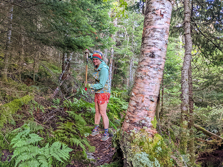
After dropping Becca’s car off on Welton Falls Road, I drove us to the trailhead in Hebron. It is just to the left of three busy bee hives. The mowed grass path from the road to the woods is steep and we followed yellow blazes along paths and old logging roads. When we crossed beneath the powerline we enjoyed a big view to Tenney Mountain and way east to the Waterville Valley area.
When we intersected the Elwell Trail we followed it west as the ‘87 guide described for 7/10th of a mile where we found a trail sign that pointed out the Welton Falls Trail, South. At first the trail seemed to still exist. We followed a slightly worn footbed and found a few old yellow blazes. But in less than ten minutes the trail became more wild and tried to hide from us. We’d play a game to see which one of us could find the next blazed marked tree. The blazes became fewer and fewer and disappeared when we hit the most recent logging operation.


The opened area along the logging road gave us splendid big views of Mount Cardigan and Firescrew and the dandy foliage was bright near peak.
We noticed stone walls and a fork of an older logging road where we believe we found the remains of the “ruined camp” described in the ‘87 guide. We poked around and found some rusty pieces of maybe an old stove pipe and a dozen or so old red bricks near the fieldstone cellar hole.
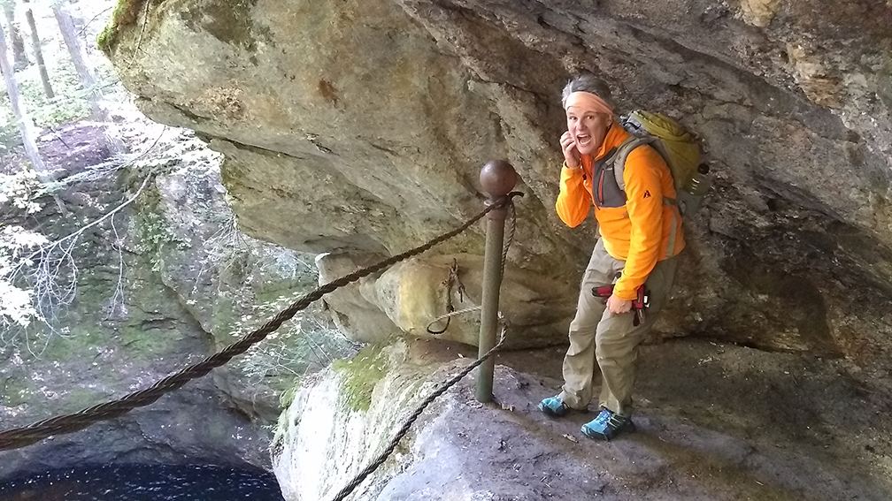
We made our way using old logging roads back down to Welton Falls Road and our car. Next up was a visit to Welton Falls since we were near the Lower Manning Trail, the trail that actually goes to Welton Falls. At the end of Welton Falls Road at the Manning Trail intersection it is just a quarter of a mile walk to reach the Falls. At one time this place must have been a very popular destination. Fancy posts and a broken cable stand guard uselessly along the edge of the steep drop off into the gorge along the trail. Even with low water flowing the falls were pretty.

We climbed down into the streambed and admired the potholes and the grooved granite formed by the friction of sand and fast moving water.
Adventuring we hiked over six miles and we didn’t see a moose or any people. On the way back to pick up my car we started discussing Sculptured Rocks, another property owned by the State of New Hampshire, but one that is popular and well known. I told Becca that I thought it was highly overrated and didn’t understand its popularity and she disagreed with me. So we decided to stop by since it was kind of on our way back home.
The parking area for the Sculptured Rocks Natural Area is the on the west side of Sculptured Rocks Road in Groton (just northwest of Hebron and Newfound Lake) and the Cockermouth River is on the opposite side of the road. Becca and I crossed the road and followed the short path to the footbridge over the geologic site. The water was low and I gazed at the smooth water carved walls of the gorge below. It by no means is a Grand Canyon, it can’t be more than 15 or 20 feet deep but it is neat looking. Becca told me I had to come back in the summer to swim in the narrow gorge and she explained that was the real attraction here.
There is a nice granite cellar hole less than a minute’s walk uphill from the footbridge. We pondered what purpose this building held; it sat on a fancy foundation long ago and so close to the gorge.
We walked up stream and we sat on a big rock in the sunshine and we ate a late slow lunch. We marveled at the dozens of leaf peepers that came and went, most people we saw didn’t even spend ten minutes admiring the rocks.
The drive back around Newfound Lake surrounded by the bright foliage was delightful. We had a good adventure.
Have fun.
Amy Patenaude is an avid skier/outdoor enthusiast from Henniker, N.H. Readers are welcome to send comments or suggestions to her at: amy@weirs.com.