
Back On Vermont’s Long Trail

by Amy Patenaude
Outdoor/Ski Writer
A year ago Liz and I started up the Appalachian Trail in North Adams, Massachusetts to reach the Vermont state line and the beginning of the 272-mile Long Trail. By late October we made it all the way to the Appalachian Gap just above Mad River Glen near Waitsfield, VT.
Last Saturday we continued our Long Trail section hike project where we had left off. Our goal is to reach the end of the Long Trail at the Canadian Border before the snow flies.
Friday night we dropped off Liz’s car at the Long Trail crossing on Route 2 in the Winooski River Valley. We spent the night at a friend’s house in Waitsfield and we were on the trail Saturday morning just before 7 am. At this point the Long Trail enters Camel’s Hump State Park and stays mostly in the Park all the way to the Winooski River. The Long Trail from Lincoln Gap to the Winooski River is called the Monroe Skyway in honor of trail builder Prof. Monroe.

Our section hike before us was 21.3 miles and with a lot of elevation. We knew it wouldn’t be easy to make good time. This has been a wet spring and it had rained earlier in the week; we could count on finding plenty of mud and slippery rocks.
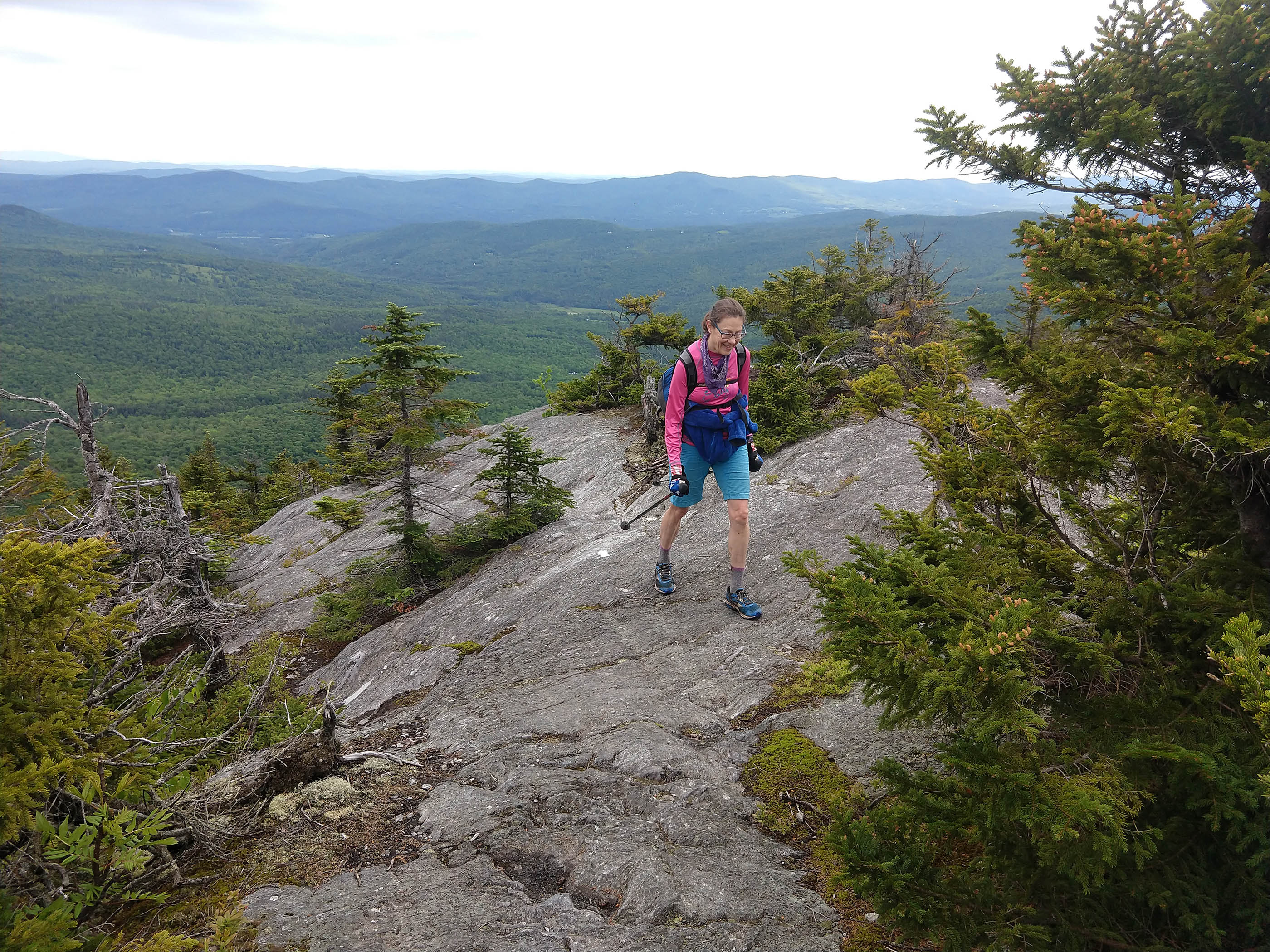
On the rugged trail we went and up and over enjoying a few seconds on Baby Stark’s Mad River Glen Lookout and on top of Molly Stark’s Balcony we took in our first look of Camel’s Hump! Yes indeed Camel’s Hump looked very far away. We were happy the vista was clear and that the predicted morning rain showers were not going to hit us.
The trail in the southern exposures were the driest and the northern were often wet and slippery–it was like this the whole hike. We had to pay careful attention to every step.

We took a minute to see the Birch Glen Camp, first constructed in 1930 and more recently updated. It was well after 8 am we were surprised that two men were inside eating breakfast.
Three miles later we passed by the Cowles Cove Shelter and two men there were finishing up breakfast and they generously offered us bowls of oatmeal (we declined). We kept on moving.
The climb up Burnt Rock Mountain was steep and ledgy. On top we enjoyed the open views in all directions. We could see Lake Champlain and Camel’s Hump still looked far away. A good breeze thankfully kept the black flies at bay while we enjoyed our summit break.

Between Burnt Rock Mountain and Mount Ethan Allen we had to climb down an aluminum ladder to reach the bottom of Ladder Ravine. I am guessing it replaced a long ago wood ladder. The rock was wet and slippery and there was a knotted rope to hang onto to help access the top of the ladder, totally sketchy move.
We met a gal that was wearing the clothing of a Green Mountain Club caretaker. She was sawing off limbs on a large tree that was just one of the few that was across the trail. We thanked her for her efforts and she remarked she was going to have to get someone with a chainsaw out here.
Nearing Mount Ethan Allen we were noticing that many blowdowns had been cut and removed. We were thankful that we didn’t have to make the effort to climb over, under or around them. We then came upon a man wearing a bug headnet sawing away at a mess of downed trees. We didn’t stop long to chat since the bugs quickly began to chew us up. We thanked him and I told him about the other trail maintainer we had met and he seemed surprised and delighted that someone else was out there doing work too.

When we passed through the Montclair Glen Lodge there were a handful of people hanging out. We sat down and took a good break before our final 1000+ foot push.
Out in the open above treeline, it became more windy and crazy windy. We met a dozen people descending the mountain and one told us that there were gusts of over 70 mph. I doubted this information since they seemed unharmed.

At 3 o’clock we stood on the 4,083 foot Camel’s Hump summit. A few dozen people were scattered over the summit sitting on the rocks. We joined them, we rested, ate and took in the big panorama.
Thinking ahead to a future hike, Mount Mansfield looked far away. But now we had to focus on 8 miles of trail and getting down 3,000 vertical feet back to our car. Going down hill isn’t easy but after 13 miles up and down a bunch of peaks it was difficult. The trail follows the ridge and across some rocky knobs that provided nice views back at the mountain. We continued to be careful each step, though both of us did slip a couple times. The hike was lovely through pretty forests, past ledges and brooks and we took our time.

When we finally hit the Duxbury Road we thought we were on easy street. Wrong, the most VEXING hiking I’ve done in a long time was just around the corner.
Four years ago, June 2015, the Green Mountain Club celebrated the 2.3 million dollar trail relocation and the new Winooski River footbridge. We didn’t celebrate.
The reroute took us off the road and through a farm field that had electric fences, a barking dog and a big electric fence pen with hundreds of chickens. The grasses and poison ivy were waist high and sometimes up to our armpits. The wet grass soaked us to the bone. When we came to the Preston Brook crossing the water was high but it was no problem since we were soaked we just waded the brook. All this time the nice flat easy Duxbury Road was in sight. Too many times to count we said we wished we’d walked the road.

The footbridge across the Winooski River is lovely and we saw a man fly fishing in the river. The walk through the town forest was short and spit us out on the railroad tracks just as a commuter train came roaring past. Seriously, I almost walked in front of a train. We almost walked in front of a train since Liz was following just a few steps behind me. This shook me up and the adrenaline was pumping in my veins. We carefully crossed Route 2 and we were done walking. The time was 8 pm and we’d been on the trail for 13 hours.
Our day was not yet over. We still had to go pick up my car at Appalachian Gap and then we both had to drive home.
The Long Trail gave us another great day to remember and we have “just” 88 miles to go to reach Canada!
Have Fun.
Amy Patenaude is an avid skier/outdoor enthusiast from Henniker, N.H. Readers are welcome to send comments or suggestions to her at: amy@weirs.com.


