Hiking North, Middle & South Tripyramid From Waterville Valley

by Amy Patenaude
Outdoor/Ski Writer
“Waterville Haystacks” was an early name for Mount Tripyramid, the big three-summit mountain that rests between Waterville Valley and south of the Kancamagus Highway in Albany. There are options to make a loop over these peaks from Waterville Valley and the Kanc. The most challenging and spectacular route is the Mount Tripyramid Trail via the North and South Slides from Livermore Road.
The North and Middle summits are included in the Appalachian Mountain Club’s 4,000 Footer List, ranked 33rd & 35th.
This was Bria’s first time up the North Slide. I haven’t been up the North Slide in a number of years and I was happy to do it again.
We met early at the Livermore Road parking lot (Forest Service fee area $5 or parking pass) in Waterville Valley.


I came from the north and drove the length of Tripoli Road to get to Waterville Valley. The road was just as narrow and bumpy as ever but okay for any car traveling slowly. I marveled at all the people camping along the side of the road, a permit is required, and most appeared to be still in their tents. Someone had a tent sent up in the middle of the Osceola Trailhead parking lot; I imagined the Forest Service would be waking them up.
Bria, Jeremy and I headed up Livermore Road, now a multi-use trail for hikers, mountain bikers and during the winter months cross country skiers. The road was lined with purple and yellow wild flowers.
We hadn’t been on the trail long before a fast moving group of three came up behind us. I attempted to charge a toll to pass and requested to be paid in Gummy Bears. Jeremy told them I was serious but the toll was not paid and we all enjoyed a good laugh.
At 3.6 miles, we turned off Livermore Road, crossed the aptly named Avalanche Brook and began our climb up the North Slide.
Steep and exposed and not for the faint of heart is the route of the North Slide. The climb is a difficult continuous scramble even in the driest conditions and should not be attempted when it is wet. There were rain showers the previous day and the lower section under the tree canopy was a little greasy. We made our way up carefully.


The exposed wide ledge slabs were dry and we did our best not to knock any loose rocks and cause them to go bouncing down the slide. We were thankful the group above us was careful too. The best route was once yellow blazed but now there are too few worn blazes left to guide the way. People are climbing up both sides and even up the middle. Sometimes Jeremy went that way and I went the other and Bria made up her own mind which way was best to go.
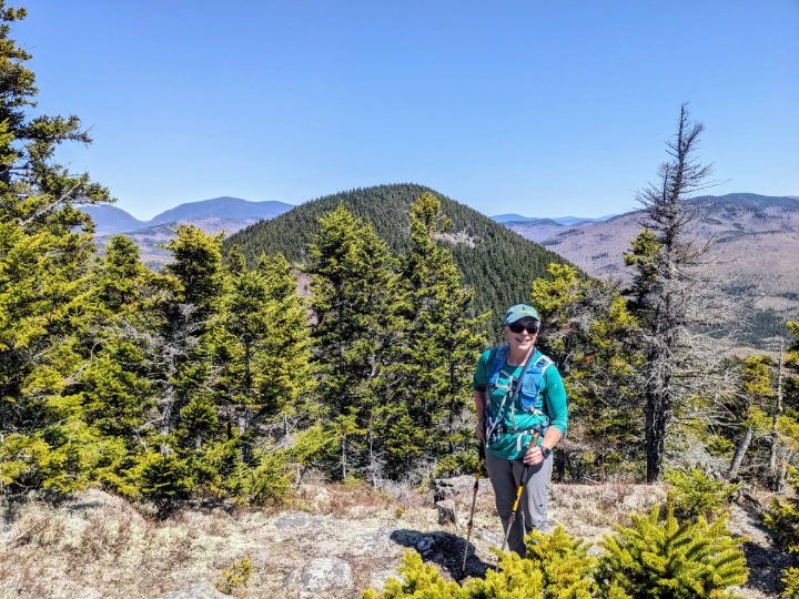
The view up and down the slide is daunting. The open mountain vista of the surrounding mountains is delightfully grand. Just before the top we found some good ledge seats and took the time to enjoy the big view. The nearby peaks of Mount Tecumseh and Osceola were front and center and interestingly we could see the rocky bump of The Captain near Carrigain and more.
As we neared the trail leading off the top of the slide the group above us appeared from the woods and they wondered which way to go. They had eagerly followed the slide straight up until it completely petered out and had to backtrack.
I hustled up to meet them and I again made my play for Gummy Bears and offered my guide services for a small fee. Four Gummy Bears later they learned they were standing between the trail and the rock cairn that marks the sharp left turn into the woods. From here the trail continues to meet the Pine Bend Brook Trail just below Tripryramid’s North Peak summit.
My friends were not pleased I did not share the Gummy Bears, I guess I should have made a better bargain or at least not have eaten them all.
We continued up and over and up again about a mile to reach Tripryramid’s Middle Peak. The threesome with the Gummy Bears were taking a break on top when we arrived. Sadly all the Gummy Bears were long gone. We poked around the trees to find some views but the views from the slides are so much better it didn’t seem worth the effort.
From Middle to South it is less than a half a mile. The climb down into the South Slide is difficult and deeply eroded. The South Slide is steep but the rocks are blocky and filled with loose gravel. The only blaze I can recall seeing is the yellow three arrow painted on the ledge pointing the way to the Kate Sleeper Trail. Lower down Jeremy pointed out what remained of a stone staircase that was hidden because it was filled over with gravel.


The slides keep sliding.
We were happy to get back on Livermore Road for the easy walk back to the car.
Along our way we took a short side trip and followed the Big Pines Path to visit the big Pine trees. Bria and I gave the trees a big hug. We didn’t even come close to reaching each other’s hands around the tree.
Have Fun!
Amy Patenaude is an avid skier/outdoor enthusiast from Henniker, N.H. Readers are welcome to send comments or suggestions to her at: amy@weirs.com.


