
Journey’s End: Vermont’s Long Trail

by Amy Patenaude
Outdoor/Ski Writer
Liz and I are finally End to Enders. We finished the Long Trail last Wednesday, all 272 miles.
We began section hiking the Long Trail a year ago last June. We hiked 20 days total; from Vermont’s Massachusetts border to its Canadian border. The trail from the northern terminus of the Long Trail is aptly named Journey’s End.
Journey’s End sounded like a mythical place when we started our northbound (NoBo) traverse. Would we ever reach it? I often wondered if our busy schedules would allow us to meet up to complete this adventure?
We did a big three day push in July to cover ground from the base of Camel’s Hump all the way over Mount Mansfield and Smugglers’ Notch to the Lamoille River Valley where the Trail crosses Rte 15, just west of Johnson, VT. It was a big effort but it set us up so that just another three day push should take us all the way to the border.
On Monday morning I drove from Franconia to meet where we planned to end our first day. I drove all the way to the top of Hazen’s Notch and arrived well before 7 am. I wondered where Liz was and I pulled out my map to kill time. I soon realized I had gone to the wrong place and I needed to be ten miles south. Yikes! She was patiently waited for me at Eden’s Crossing on Rte 118.


We left her car behind and I drove us south where we had last left the trail. My error made us nearly a full hour late and we had 21 miles to hike. We had a great day on the trail and after all the big mountains we had hiked behind us, these rolling hills went by quickly. The Long Trail here see much less traffic since people aren’t out to visit these small peaks.
A few miles before reaching our car the trail went right through Devil’s Gulch, a deep and tight gulch filled with a jumble of large rocks. It reminded me of Ice Gulch in Randolph, NH because the air between the rocks felt welcomingly ice cold.
We slept at the Black Lantern Inn in Montgomery since we had no friends living this far north in Vermont. (We managed to stay with friends all but 4 nights the whole adventure.) After cleaning up and grabbing some supper we dropped our Liz’s car at the top of Jay Pass.
The next morning at 7am we were hiking up Belvidere Mountain. From Eden Crossing to Jay Pass was a hair under 17 miles but we’d be climbing a good handful of 3,000 foot peaks and the threat of afternoon thunderstorms was real.

The Belvidere lookout tower was a highlight, it is super tall and gave us an early morning hazy view all the way back to Mount Mansfield. The descent from Haystack Mountain down to Hazen’s Notch felt extra steep and long after a very rugged 10 miles of hiking and we still had almost 7 miles to go.
We met a few southbound hiking groups in a hurry and we passed a Nobo hiker and his little dog Pippy. I thought he said Hippy but Liz corrected me. The sky was getting dark and I understood why everyone seemed to be in a hurry. From the top of Domey’s Dome we had almost two miles to descend to Jay Pass and it started to rain. During our last half hour we endured drenching rain and thunder boomed above us.
We were soaked and we drove to fetch my car and then we drove north to drop Liz’s car off at the Journey’s End trailhead. We were too beat to go out to eat, so we picked up deli sandwiches at the market in Center Montgomery and took them back to the Inn.

After cleaning up and putting on dry clothes we sat on the porch and ate our sandwiches and watched small town Vermont go by–a young kid driving a go cart down the main road and a loud car revving its engine for us. The Inn’s wifi worked well on the porch and we checked the weather forecast. Big chance for thunderstorms after 8 am all day Wednesday. Eeek!
We decided we better hit the trail at 6 am to get over the open ledges of Jay Peak, we didn’t want to get blasted off the mountain. We were on the summit by 7:15 am and the clouds rested in the valleys providing a fine undercast for the mountaintops to poke through above the clouds.
Inside the Jay Peak Tramway house there is a room with a glass door where we could see two hikers still sleeping inside.
I’ve hiked Jay Peak before and thankfully the mud and slippery rocks were not as bad as I had remembered. When we passed the Woodward Shelter a SoBo hiker was just finishing breakfast. I thought he should have been more worried about the weather. Liz and I pushed on, we were tired but we wanted to hike as much as we could before it started to rain. The trail was brushy and would have been a carwash if it were wet. We decided to push on all the way to the Shooting Star Shelter and take a big break there.
We stretched out and ate a big early lunch. Then two thru-hikers came through and they weren’t happy that the Shelter’s water source, a pump, was dry and they took right off. They were ready to finish.
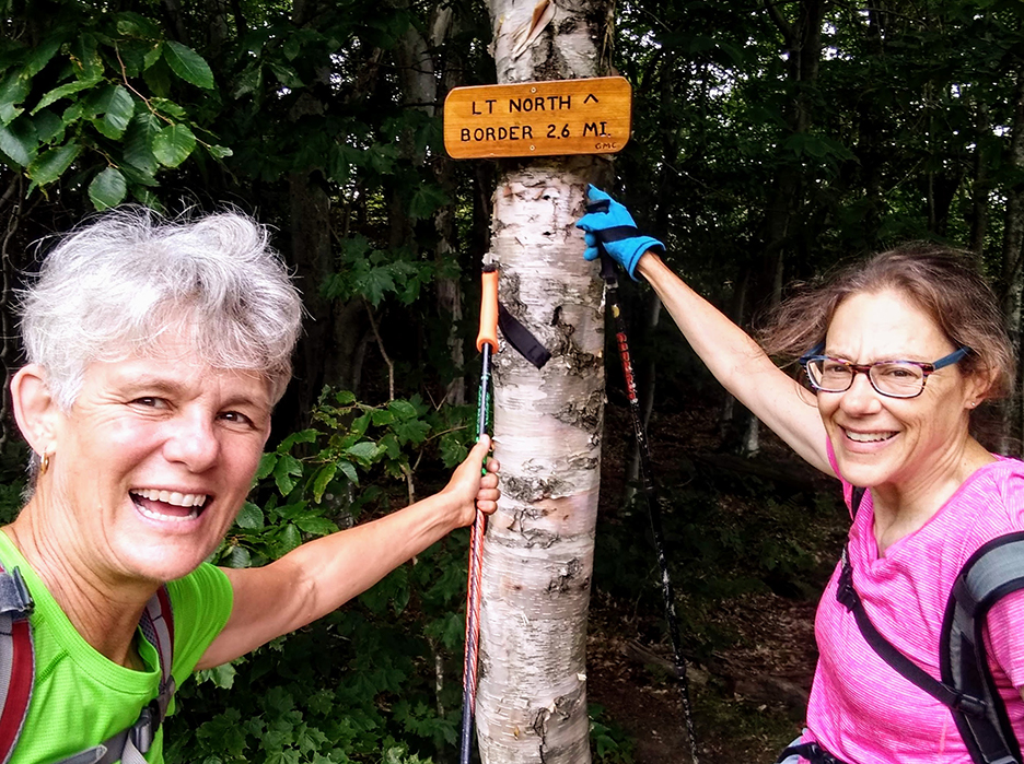
At the Rte. 105 crossing we were surprised to see the results of an almost completed road widening project at the height of land. We liked the sign that read 2.6 miles to the border.

Up and over Carleton Mountain and then down to the border and to the Journey’s End, we excitedly bopped down the trail. When we reached the boundary swath the thru-hikers were sitting there having just arrived themselves. Interestingly, the border is not a straight line but a series of lines connecting hilltops to hilltops, zigging and zagging. We took photos of one another and chatted. They had been 20 days straight on the trail. We told them we had done 20 days too with our shortest day being just 5 miles with several long days of over 20 miles.
Ten minutes later we all headed down the trail together and now our car was just over a mile away. They decided to wait for their ride at the Journey’s End Camp and to try to find some water. I stopped and reached into my pack and handed them a full liter of water and a Kit Kat bar. One remarked that this was what he was dreaming of as he held the chocolate bar in his hand. Hiker hunger is real.
Just before we reached the car it started to sprinkle. As soon as we plopped ourselves into the car seats it started to rain hard. Wow, a fairytale ending indeed.
The thunder was loud as we drove through the rain to fetch Liz’s car. We made many good memories and we couldn’t believe our feet were still dry. We said a quick goodbye and home is a long way from the Journey’s End.
Have Fun.
Amy Patenaude is an avid skier/outdoor enthusiast from Henniker, N.H. Readers are welcome to send comments or suggestions to her at: amy@weirs.com.


