
Mount Hale
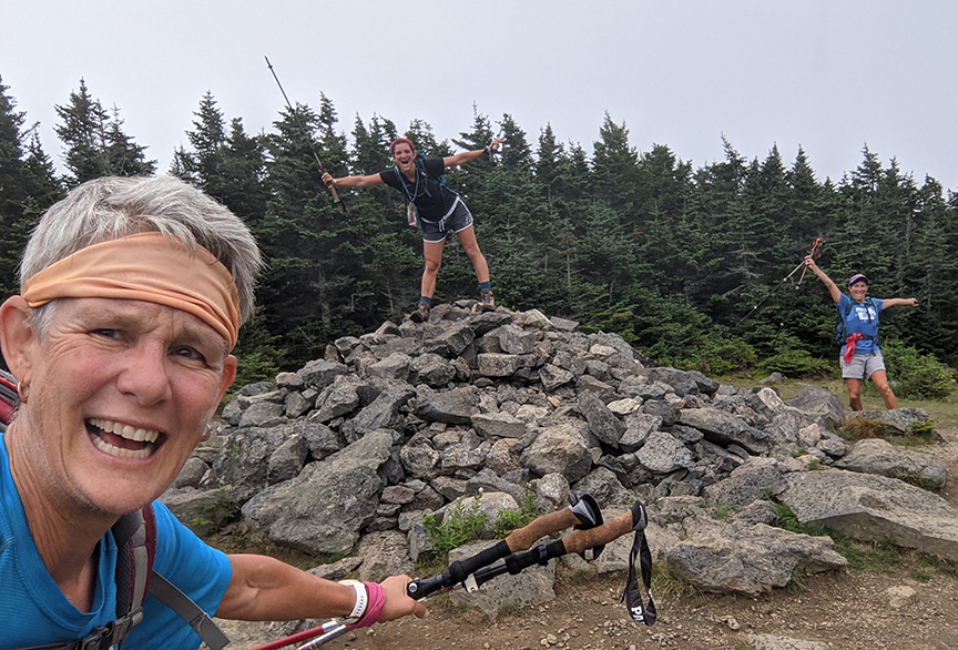
Photo: Yeah we made it to the top of Mt. Hale, elevation 4,054 feet and ranked #37 in height on the New Hampshire 4000 footer list. The viewless summit has magnetic rocks that will cause your compass to spin. Mt. Hale is a good peak to do on a cloudy or rainy day.

by Amy Patenaude
Outdoor/Ski Writer
Peak Baggers have to collect peaks even when the weather isn’t very nice or they’re feeling a little tired. Especially if their time is limited.
My old college friend Sue came up from Maryland to New Hampshire to help her daughter Anna settle in for grad school at Southern New Hampshire University. They came up two days early to hike mountains and to happily check them off the New Hampshire 4000 footer list.
It was four years ago when we hiked Moosilauke and the Presidentials Range peaks together when Sue got the bug to finish the list. She bought all Steve Smith’s guide books and Sue has been wanting to get back to work on the list ever since.
They planned their hike and they started bright and early. They hiked up the Greenleaf Trail and summited Lafayette and then they traversed across the Franconia Range all the way to Mount Flume and then they backtracked to Mount Liberty to descend via the Liberty Spring Trail.
Good weather accompanied them all their long day. They enjoyed the trails and the views. They even met a few Appalachian Trail thru-hikers along the way.

At suppertime I met them and we all went to the Rek-Lis Brewing Company to celebrate. We had a comfortable table out on the deck and it was wonderful to hear their account of their adventure.
I was amazed they seemed not to be worn out after almost a 12 hour day. They were excited and full of adrenaline. Between mouthfuls of nachos we decided to hike together the next morning before they had to return to Manchester.
But the forecast wasn’t good—rain, rain, rain. But I assured them it was okay. I knew the perfect peak on the 4k list: Mount Hale.
Mt. Hale is a popular New Hampshire 4,000 footer peak to hike on a cloudy or rainy day. The trail has decent footing, it isn’t too steep or long and the forest is lovely. But the main reason is that there is no view from its summit. The trees have all grown tall and block out what was once an excellent view of the big mountains of the Presidential Range.

Mount Hale was once home to a fire tower that sat on Hale’s cleared summit. The tower was built in 1929 and torn down in 1972.
Oh well, if I ever win the lottery I’ll rent a Blackhawk helicopter and set a new lookout tower on Hale’s summit–shhh don’t tell the Forest Service.
The smell of coffee encouraged the gals to get out of bed and get ready to go again.
The Hale Brook Trail begins 2.5 miles up the Zealand Road from Route 302 (between Twin Mountain & Bretton Woods). There is a small gravel parking lot and an information kiosk at the trailhead.
It wasn’t raining yet, just hot and muggy. The lot already had 5 or 6 cars in it, others were trying to beat the rain too.
The trail climbs 2,300 vf in 2.2 miles; it was a good steady climb. Hale Brook was an easy rock hop across and the sound of its cascading water was joyous to our ears.
We met a couple of people already on their way back down. The sky was cloudy and the air felt misty when we reached the top.


The big rock cairn was being guarded by a snake. Sue managed to scare it off when she went to get a closer look. The footings and the concrete step and some steel pins are all that remain of the former fire tower.
I pulled out my compass and put it near the cairn’s rocks and we watched the needle spin around. Many of the rocks are magnetic. I learned this by reading my White Mountain Guide!
We trotted down the mountain and the rain held off but we were really hot and sweaty by the time we reached the car. The adventure was not quite 3 hours long but it was a lot of fun to be together.
And now Sue has 13 of the 48 NH 4ks checked off. I am sure I will see her again soon.
Amy Patenaude is an avid skier/outdoor enthusiast from Henniker, N.H. Readers are welcome to send comments or suggestions to her at: amy@weirs.com.


