Single Day Bonds-Zealand Traverse

by Amy Patenaude
Outdoor/Ski Writer
There are 48 peaks on the New Hampshire 4,000 Footer list and the most remote are the Bonds. The three Bond peaks are far in the federally designated Pemigewasset Wilderness and a long hike is required to reach them.
The traverse from Lincoln Woods on the Kancamagus Highway to the end of Zealand Road (near the backside of the Bretton Woods Ski Resort) is just shy of 20 miles and up 4,600 vertical feet.
There are a few ways to hike the Bonds and Zealand Mountains and none of them are easy. Many people will do the trip over two or three days by camping along the way. My friends Sarah and Sharon, the golfing gals, had no interest in camping and they nervously opted to do it in a single day.
I knew they could do it but it would be a long day. This summer they’ve hiked Owls Head, the Twins and a good number of rounds of golf on hilly courses. I estimated they would do it in 12 or 13 hours if all went well and we’d do it on a day with a good weather forecast.
I’ve led other family and friends on this route and this past winter I did it—I knew these mountains stunning vistas would keep them energized for their longest hike ever.
I also invited another hiking friend to join us. This would be Bria’s first visit to these peaks too.
At 6:30 am, we posed for a photo on the suspension bridge and we quick-stepped up the Lincoln Woods Trail that follows upstream the East Branch of the Pemigewasset River. For 4. 7 miles we hiked on the old logging railroad bed before I walked us off the trail and right up to someone’s tent. We had not quite reached the turn for the Bondcliff Trail and I had mistaken a camping herd path for the trail. Thankfully it was an easy backtrack to find the trail; I must have been sleep walking.


Then the Bondcliff Trail follows old logging roads and crosses Black Brook four times. The lower water crossings were easily rock hop-able and the upper two were dry. The rock staircase was in good condition and it is nice that erosion is being kept under control here. But it is sad that the trail just below is muddy and getting washed out.
Up the trail the four of us went and as we were scrambling up a short but steep ledge a backpacker caught up to us. We offered to let him go by but he declined. He respectfully held back and didn’t push us; he passed us later on the summit.
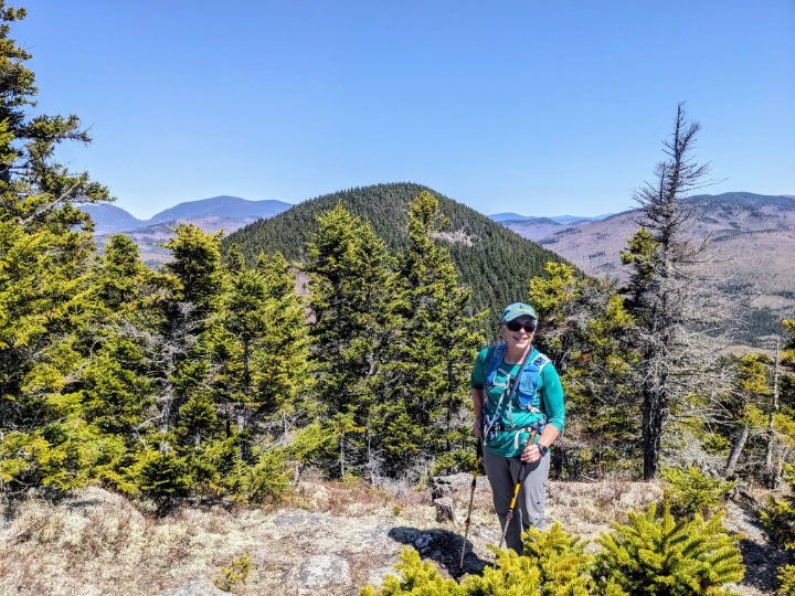
After hauling ourselves up the ledge we were close to the summit and we were standing above the scrubby trees and looking out at the big view. I pointed to the clouds and noted that they were covering the Franconia Range but everything else was in the clear.
In a couple minutes we were above tree-line and the trail parallels the steep edge of Bondcliff’s cliff! Sarah is no fan of heights and bravely and calmly kept her eyes to the east far from the edge. Bria and I were excited to run ahead and out onto the piece of Bondcliff that abruptly sticks out and appears to be hanging off the side. Sarah and Sharon watched us and told us we were crazy as they snapped our photo.
As we hiked off of Bondcliff and towards Mt Bond the clouds started to lift from south to north on the Franconia Ridge and the sun got brighter in the sky. We enjoyed the rugged mile of open trail before we headed back into scrubby trees. We climbed up and over big rocks and an extra slippery ledge before popping out on Bond’s bare summit.
We had hiked 10.3 miles and reached the summit of the highest peak of our traverse by noon. We sat on Mt Bond and enjoyed a good long lunch along with the mountain panorama. We could see where we had been and we could see where we were headed. Mountains and forest filled our eyes. From Bondcliff, Mt Bond blocked our view but on Mt Bond we had a clear view north and Mt Washington and the Presidentials were visible and everything in between.

The trip off of Bond to the intersection of the spur trail to the West Bond spur went quickly. We dropped our packs at the intersection and walked the half mile to West Bond’s summit. Walking without the weight of our packs on our backs felt like we were floating. On the summit the fellow that passed us on Bondcliff was enjoying a leisurely moment. He was in no hurry because he was spending the night at nearby Guyot Shelter. We took a short rest and soaked in the view and especially of where we just hiked.
Again we shouldered our packs and it was a short distance to reach the Bond-Guyot col and the path to the shelter. Bria wanted to hike the path and go down to see the shelter and I went with her. Sharon and Sarah decided to continue and would meet us on bare summit of Guyot.
Bria and I dropped our packs and hustled. The path is almost a quarter of mile and drops a couple hundred feet to the campsite. We did enjoy the fresh spring water at the shelter.
We caught up with our friends and together we hiked over Guyot’s higher north peak before going down and then back up to Zealand Mt.
On Zealand we followed the 1/10th of a mile path to the viewless heavily wooded summit. The summit sign was what we came to see.
With 14 miles behind us we still had work to do to get down to the Zealand Falls Hut. We all made it down the steep section with the widely spaced rung ladder “built for a giant.” I promised that view from Zeacliff would be super and a good place to take a break before our tough descent.
On the way Bria and I took a short detour down to visit the little Zeacliff Pond and looked back up at the steep mountain.
The view from the top of the Zeacliff’s ledges was worth the effort to keep moving and we enjoyed our last big vista—yah another view with all the big mountains! The pointy peaks of Anderson and Lowell along side of Mount Carrigain’s bumps is my favorite. My friends appreciated seeing Mts Willey, Field and Tom and memories of our wintery traverse came flooding back to us.
The next mile down to the hut was the longest mile—steep, slippery, rocky and wet. That mile took us almost an hour.

We were very happy to cross the White Wall Brook because we knew we’d be at the hut soon. We took a short stop and checked out the hut, chatted with some hut guests and looked at the falls and back on the trail we went together.
Just like in the morning we quick-stepped down the trail. The Zealand Trail’s extensive board walks and the tree’s leaves rapidly turning colors around the ponds made the trail lovely and interesting. These last miles felt like the shortest miles of our adventure. All the tough terrain and climbs were far behind us.
At 6:30 pm we tossed our packs into the back of my car that my husband Charlie had helped me drop off the previous evening. Now all that was left to do was to drive back to Lincoln to retrieve the cars and to plan our next outing during a celebration supper at Gordi’s.
Have fun.
Amy Patenaude is an avid skier/outdoor enthusiast from Henniker, N.H. Readers are welcome to send comments or suggestions to her at: amy@weirs.com.


