Skyland Trail To Orange Mountain
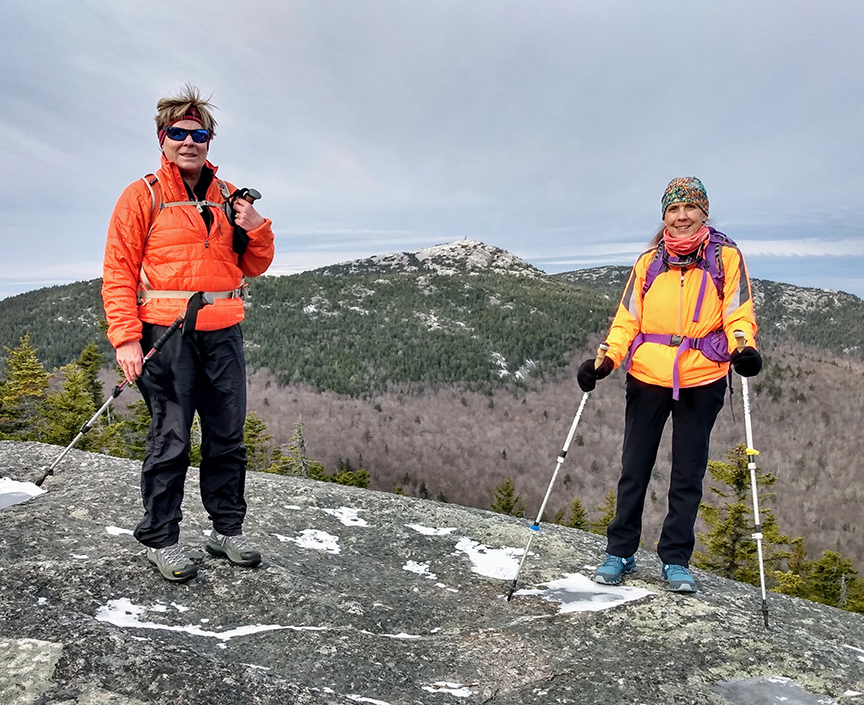
PHOTO: Sharon and Sarah, the golfing gals, on the open ledges near the summit of Orange Mountain with a big view of nearby Cardigan Mountain. The Skyland Trail traverses the southeast ridge between Cardigan Mountain and Alexandria Four Corners, crossing over Brown, Church, Grafton Knob and Orange Mountains.

by Amy Patenaude
Outdoor/Ski Writer
Mount Cardigan’s southeast ridge is traversed by the Skyland Trail. This lightly used trail begins runs between Alexandria Four Corners and where it meets the West Ridge Trail below Cardigan’s summit. Finding the trailhead is part of the adventure.
Sarah and Sharon, the golfing gals, asked me to take them on a local hike. We met at the Danbury Country Store and I led the way. The pavement disappeared quickly and we drove the long dusty gravel roads up to the Alexandria Four Corners. A flagpole and a row of mailboxes sit in the middle of the intersections of Grafton Road, Washburn, Orange and Knowles Hill Roads.
At the Four Corners we parked along the edge of Orange Road. The directions in the AMC Southern New Hampshire Trail Guide smartly point out not to block any driveways or roads.


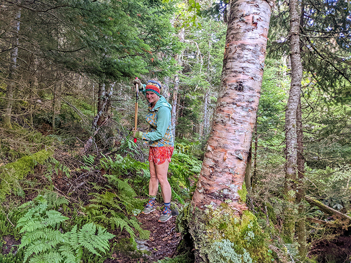
We walked up the narrow Knowles Road a short distance and then left up the not town maintained Church Hill Road until we came to the Skyland Trail sign. The sign is on the right and it points to go left into the woods where a tree has a white blaze. The trail feels like a grown in road here and soon you will see the Skyland Trailhead sign. The Skyland Trail is well marked with white blazes but leaves covering the foot bed this time of year can make following the trail tricky.
Our goal was to make it three miles up the trail to Orange Mountain (sometimes called Mount Gilman) and then follow our tracks back.
The three of us headed up the trail and nearing Brown Mountain’s shoulder on the right we noticed an old collapsed log cabin and a little further up the trail we spied piles of rocks that were once footings for a building.
The Skyland Trail is rolling. We climb up and over and then back down and repeat. Up and over the wooded top of Brown Mountain, then up enjoyed an ledgy outlook on Church Mountain before we descended again. We then climbed up to Grafton Knob where we enjoyed a bigger view south. We could see that Ragged Mountain’s slopes shine bright white because of their recent snow making efforts.

We dressed warmly and brightly. Since it is hunting season we all donned our hunter orange clothing. Sharon’s hands were chilly and she pulled out a packet of hand warmers and stuck them in her gloves. Sarah said she was glad I reminded her to dress in orange because she had originally dressed to impersonate Bambi.
The climb up Crane Mountain is the most rugged section of the trail. The trail rises steeply around a near vertical bare ledge. From Crane’s summit there are good views and our good first view of Orange Mountain and Cardigan Mountain.
The trail grade from here to Orange is gentler, but this is where we encountered icy patches in the trail. We took our time and great care to not slip and fall. As we neared Orange Mountains’ summit, over its open ledges we enjoyed a grand mountain vista. Mount Cardigan was big and huge right next to us. Far away we could see Lafayette and a bright white peak that at first we thought was a cloud but we are certain it was Mount Washington. Tecumseh, the Tripyramids were easy to point out too. And we could see the blue water of Newfound Lake.

This time of year when it is very dark at 4:30pm we take our turn around times very seriously. We planned to turn back in two hours at 1:30 and we did just that. We had just enough time to spare before heading back down the trail to take ten minutes to enjoy the view longer while we ate and drank what we carried in our packs. I brought along a thermos of hot chocolate. Sarah and Sharon had peanut butter and jelly sandwiches.
Once again we were very deliberate with our steps as we made our way across the icy sections of the trail and we were happy to have the ice behind us. Going back we made better time because now the downhills were much longer than the uphills. The trail is so rolling that all the uphills felt short. I don’t think we stopped once on the way back.
The trailhead sign delightedly surprised Sharon because she thought we had one more bump to go over. The downhill road walk back to our cars went by fast. It was a fun cold hike and we were glad to get one more hike in together before winter settles-in and these snowbirds fly south.
Have Fun.